Application of Revit for Landscape Architecture
Table of Contents
- Significance of Revit in Landscape Architecture
- Features that Make Revit a Valuable Tool for Landscape Architects
- The Role of BIM in Landscape Architecture
- Design for a Better Future: Sustainable Design Practices With Revit
- Benefits of Using Revit for Landscape Architecture
- Limitations in Revit for Landscape Architecture
- Final Thoughts
Design demands numerous trials and occasional setbacks to reach the most optimal solution. Traditionally, hand-drawn sketches and technical drawings have been the medium through which designs were materialised from the conceptual to the execution stage. Since these conventional methods are time-consuming and offer limited flexibility to experiment with design, the AEC (Architecture, Engineering, and Construction) industry has rapidly transitioned in the past few years to BIM (Building Information Modelling) software like Revit for improved design feasibility and performance.
The question is, can landscape architects also do the same? If yes, how effective can BIM application be for landscape architecture?
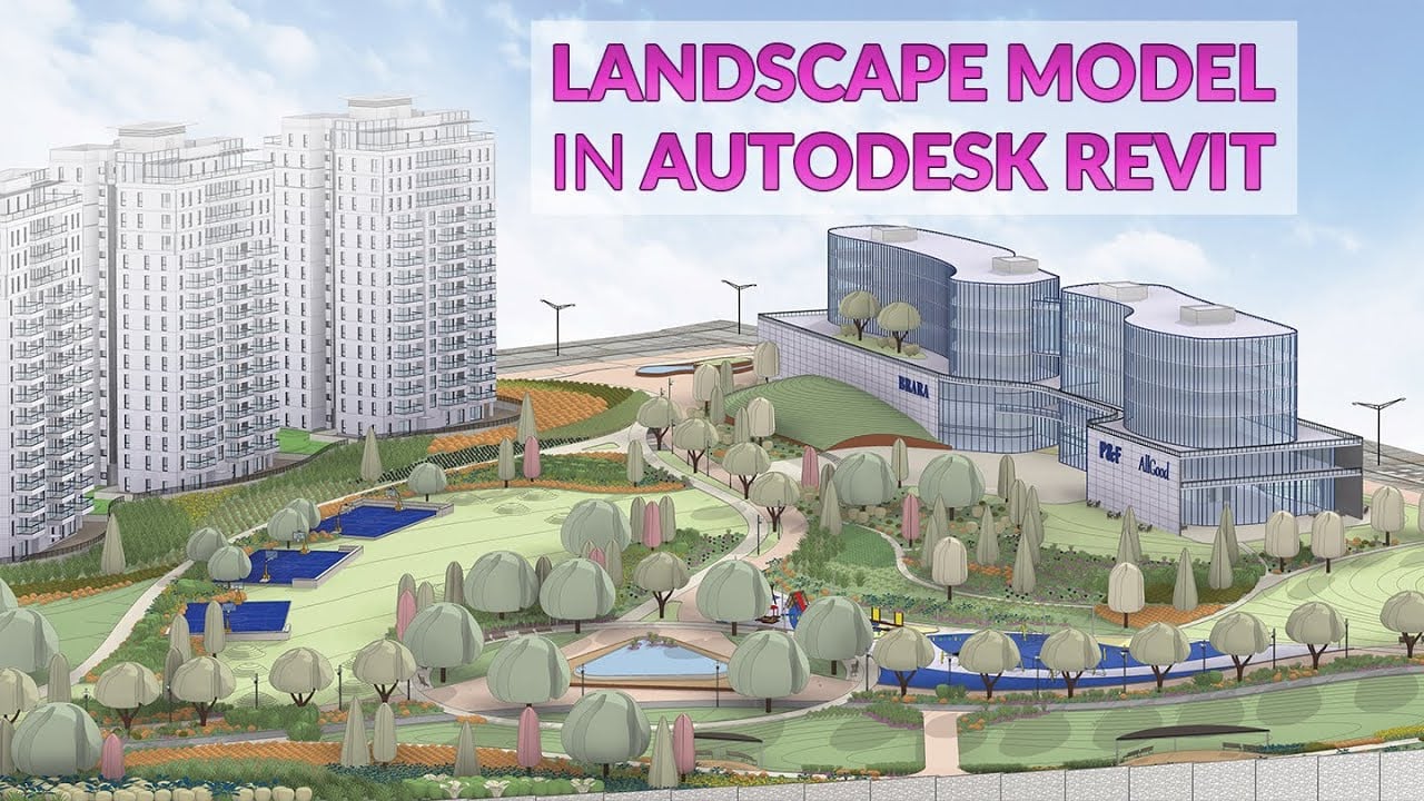
Revit, a popular BIM platform commonly used for architectural and construction projects, is widely recognised for its capability to create intelligent 3D models. Primarily used in building design, it has evolved into a valuable tool and is used across various architectural disciplines, including landscape architecture.
Significance of Revit in Landscape Architecture
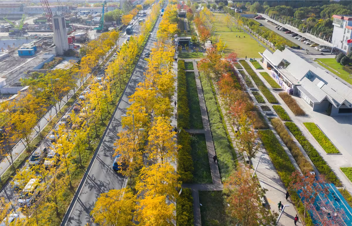
The adoption of Revit in landscape architecture is gaining popularity because it enables architects to create accurate digital landscape models with well-coordinated data. Landscape architects are finding value in generating intricate 3D models via Revit that extend beyond structures, capturing the dynamic aspects of outdoor spaces. This software enables a holistic approach to landscape design, considering the physical layout and factors like environmental impact and future changes.
Features that Make Revit a Valuable Tool for Landscape Architects
1. Topography Modelling
Landscape architects frequently deal with site data in the form of 2D drawing files, which most often include the Z coordinates with elevation values, aka Z positions. These coordinates can be seamlessly imported into Revit and transformed into a 3D topography or toposurface. The drawing must be well-drawn for optimal results, with correct levels having dedicated layers. The layers ensure that selecting and incorporating changes to specific layers becomes easy when working in Revit.

2. Creating Sustainable Designs
Revit allows landscape architects to assess the impact of their designs on the environment with tools for analysing sunlight, shadows, and environmental conditions. They also enable architects to conduct energy analysis via cloud-based services, run simulations for energy efficiency, and develop and implement sustainable designs. It involves a comprehensive project evaluation through three crucial lenses - environmental impact, financial viability, and social compatibility.
Also Check out: Introduction to Revit Families: Helpful Features From Revit for Better Efficiency
3. Parametric Tools
Parametric tools enable landscape architects the ability to visualise and create flexible and adaptive designs. This feature is handy for experimenting with design iterations and responding to changes at various stages of the design process. When one element is modified, all related elements are updated automatically, ensuring design consistency and reducing errors.
4. Rendering
- Revit offers powerful rendering capabilities, allowing landscape architects to create realistic renderings and design walkthroughs. This helps them convey the intended aesthetics and communicate designs to clients and stakeholders effectively.
- It allows landscape architects to add realistic lighting and materials to their models, improving the visuals' quality. This enhances how architects present and communicate their designs, creating a more engaging client experience.
- It also allows designers to create animated simulations, like construction sequences and sun paths, to analyse various project aspects.

5. Creating Data-driven Models
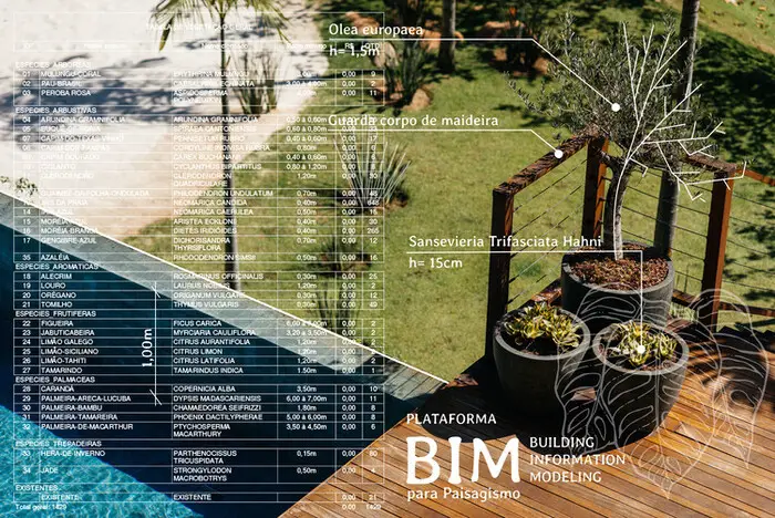
BIM tools rely on data to define every element in the model. This data-driven approach provides significant flexibility, making landscape models more effective, visualisations easier, and collaboration accessible. With Revit, landscape architects can attach relevant data, including plant species, environmental conditions, and maintenance requirements to model elements, providing a comprehensive design understanding. It results in improved accuracy, scalability, and clash prevention among other benefits.
6. Creating Families
Families are reusable objects which, once created, can be reused in different projects, enhancing consistency in workflows.
7. Collaboration
Revit promotes collaboration among other diverse teams, allowing professionals to work within a shared model. This ensures seamless contribution from architects, engineers, and other stakeholders fostering a cohesive workflow.
8. Data Integration
Revit supports different file formats and allows the import and export of data from other software applications like AutoCAD and Excel. Additionally, it enables designers to link external data sources, ensuring automatic updates. This maintains consistency and simplifies collaboration among various stakeholders.
The Role of BIM in Landscape Architecture
Why BIM?
While BIM has commonly been used for the design and construction of buildings, many landscape architects are now embracing it for creating detailed and data-driven designs.
Revit is a BIM software that is widely used for structures and helps in developing functional landscapes. Landscape architects enhance project efficiency by leveraging the detailed data from BIM platforms and seamlessly incorporating it into the projects.
How Does BIM Encourage Collaboration for Landscape Projects?
Designing landscapes with BIM streamlines collaboration within a centralised platform. It allows designers to visualise and analyse design options, understand the impact on nearby structures, and identify conflicts. The shared platform allows architects, engineers, and other stakeholders to work within the same model, promoting a more integrated and efficient workflow. This minimises errors, improves data consistency, and ensures all team members are on the same page throughout the design and construction process.
How Does BIM Streamline the Construction Process?

BIM significantly streamlines the construction process by allowing contractors to generate accurate quantities and develop detailed schedules and sequencing. BIM models also serve as a reference for on-site activities, ensuring construction aligns with the approved design. It also aids in clash detection, enabling early identification and resolution of clashes between different building systems, thus minimising rework, cost overruns, and saving time.
Design for a Better Future: Sustainable Design Practices With Revit
Revit is a powerful tool for integrating sustainability into landscape designs. Let’s understand and explore factors that make it possible.
1. Passive Design Techniques
Landscape architects can incorporate passive design techniques into their designs using Revit by optimising a design’s form and orientation. Revit’s parametric modelling features enable quick simulations and iterations, assuring better design performance. This not only helps maximise natural light and reduce heat gain but also improves the well-being of users.
2. Material Selection
There is an option in Revit to specify material details and evaluate how these materials will affect the environment in the long run. Architects can analyse the outcomes by considering factors like carbon footprint, recyclable materials, and energy efficiency and make informed decisions. They can also use the library of sustainable materials available in Revit.

3. Energy Efficiency
To maximise energy efficiency, architects can evaluate various design approaches based on heating and cooling. Revit provides information regarding design components, including HVAC (Heating, Ventilation, and Air Conditioning) systems, glazing and renewable energy sources, which can be used for developing designs that use less energy and do not harm the environment.
4. Daylighting Analysis
Architects can use the daylighting analysis in Revit to assess how the natural light is used across various designs. By analysing, they can increase the amount of natural light and reduce the need for artificial lighting by iterating layouts and designs. This results in conserving energy, reducing the dependency on artificial lighting and occupant well-being.
Also Check out: Dynamo For Revit: Everything You Need to Know
5. Rainwater Harvesting
Effective water management is the only solution to combat the global water crisis. Revit tools enable landscape architects to incorporate rainwater harvesting systems and grey-water cycling. A design's water efficiency can be improved by modelling water use and evaluating water-saving techniques. Revit simplifies the choice of effective water conservation solutions through its comprehensive analysis capabilities, which support sustainable water management.
6. Cost Analysis
With Revit, architects can perform cost analysis by evaluating the financial feasibility of designs. By considering factors like initial building costs, maintenance, energy savings, and operational expenses, designers can balance upfront investments with long-term financial benefits. Revit’s parametric modelling allows the exploration of different design scenarios, aiding architects in finding sustainable and affordable solutions.
7. Well-Being of Users
Using Revit, designers can implement eco-friendly design principles, which also improve the comfort and well-being of users. They ensure a high-quality, healthy, and comfortable indoor environment by prioritising indoor air quality, acoustics, insulation, and ventilation.
Benefits of Using Revit for Landscape Architecture

1. Effective Collaboration
Landscape architects can not only create visual models while developing their designs but can also provide precise data for models with Revit. They can give a breakdown of the different elevations of the landscape along with information regarding the materials, quantities and costs.
This makes collaboration effective for various projects within diverse teams where multiple users can access and make revisions to the model simultaneously. It helps to keep projects on schedule and prevents reworks and overspending. Revit’s interoperability feature allows multiple teams to collaborate with other products and plugins.
2. Better Coordination
Using Revit, landscape architects can collaborate with architects, engineers, and other professionals while maintaining a smooth workflow. It is possible to accurately convert 3D models into 2D drawings for the site workers, ensuring no details go missing. Revit offers several tools to ensure effective coordination between file types, models, and projects. All members can keep track of the changes and revisions on the same project.
3. Family Creation
Revit families are specific elements that can be added to a 3D model, each with a graphical representation based on shared properties. Landscape architects can either create their models or use existing Revit families from the library as per design requirements. It significantly reduces rework, ensures uniformity, and accelerates project completion. Moreover, models and families developed for one project can be saved in a library for future use in subsequent projects, promoting efficiency and consistency.
4. Automation
All essential information for a Revit model is stored in a unified database. This ensures any change made to the model is automatically updated in the database, reflecting modifications throughout the entire model. This automation not only streamlines but enhances the efficiency of the design process.
5. Planning & Scheduling
Revit modelling simplifies project management by effortlessly generating reports on materials, costs, and layouts. The scheduling feature in Revit is a time-saving alternative to traditional workflows, with automatic schedule updates when changes are made in the model.
6. Clash Detection
Revit detects design errors in the initial stages, addressing flaws and faults before they occur. This proactive identification helps architects, engineers, and builders to prevent mistakes and save time, money, and effort that would otherwise be at risk without early detection.
Also Check out: Revit Vs SketchUp: Which Software is Better & Why?
7. Cloud-Based Services
Revit models can be accessed from anywhere and at any time. It allows users to save, modify, annotate, and communicate on models in real time. This seamless integration enhances collaboration and accessibility, making project management more efficient and responsive.
Limitations in Revit for Landscape Architecture
1. Complex Terrain Model
When it comes to complex terrain modelling, Revit may lack a few advanced capabilities. Creating intricate terrains may require additional workarounds or supplementary tools.
2. Interoperability
While Revit supports interoperability with various file formats, there can still be challenges when exchanging data with other design software, potentially leading to information loss or format discrepancies.
3. Lack of Specialised Plant Database
Revit may not offer an extensive database of plant species. This could limit the options available for specifying and detailing plant elements.
4. File Size and Performance
Large and complex landscape models in Revit experience performance issues, leading to slower processing times and potential challenges when working on extensive projects.
Despite these challenges, many landscape architects successfully use Revit by supplementing its capabilities with other specialised tools when needed. As the software evolves, updates may address some of these limitations, enhancing its suitability for landscape design projects.
Final Thoughts
The impact of Revit on landscape architecture is undeniably transforming the way designers conceptualise, plan, and execute outdoor designs. The software’s robust features, from terrain modelling to seamless collaboration, not only streamline workflows but also encourage a holistic and sustainable approach to landscape architecture. By embracing Revit, landscape architects can unlock new possibilities, incorporate groundbreaking designs and inspire the future of our built environment.
If you wish to learn Revit and 15+ other BIM software, enrol BIM Professional Course for Architects by Novatr. The course is taught by professionals working in leading architectural and engineering companies globally and provides you with an opportunity to test your theoretical skills practically on a capstone project. You also get to learn soft skills to ace job interviews and secure a job in leading organisations.
For more information about the course or the AEC industry, visit our Resources Page.


 Thanks for connecting!
.jpg)
.png)


-1.png)

