Civil engineering is a science of precision. Even the difference of a millimetre can make a huge impact on the structural strength and integrity of a building. So, accuracy in documentation plays a significant role in developing construction drawings. This is where the concept of surveying in civil engineering steps in, thereby streamlining the design and build processes.
What is Surveying in Civil Engineering?
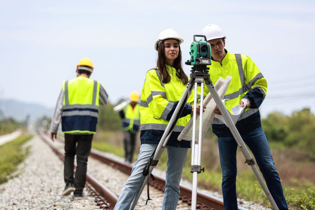
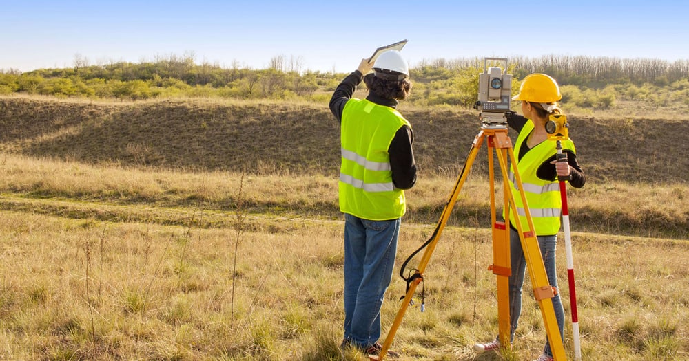
The definition of surveying in civil engineering outlines the process of measuring and mapping the Earth’s physical features to accurately determine positions, distances, and angles for construction and infrastructure projects. It serves as the foundation for planning, designing, and executing projects like flyovers, bridges, roads, and pipelines. Surveying ensures that construction aligns with design specifications and takes into consideration the natural features, boundaries, and legal property lines. The professionals who undertake such activities are called surveyors who collaborate with geologists, structural engineers, architects, and environmentalists to produce factually correct documents.
Importance of Surveying in Civil Engineering

As mentioned above, the application of surveying in civil engineering is primarily focused on providing essential data and bringing more practicality to construction. With this understanding, let’s explore the importance of surveying in civil engineering.
-
If you are searching the internet for the keywords “define surveying in civil engineering”, it provides essential data for creating building construction and infrastructure projects.
-
It ensures legal compliance by establishing property lines and avoiding disputes over land ownership.
-
Surveying identifies the natural topography, contours, landscaping, slopes, elevations, water bodies, and other physical features that may impact land development.
-
If you look up the surveying definition in civil engineering, you’ll gauge that it helps identify potential hazards like unstable slopes or flood-prone areas.
-
Through surveying, professionals can ensure efficient use of materials and minimise project costs by preventing errors and rework.
-
Surveying ensures that projects adhere to zoning laws, environmental guidelines, and construction codes.
What are the Objectives of Surveying?

The objectives of surveying in civil engineering fundamentally include data collection, analysis, and organisation for supporting construction processes. Now, let’s have a closer look at the additional goals that can be achieved through effective surveying in civil engineering.
-
Establish the locations and relationships between different points on the land for creating maps and layouts.
-
Set benchmarks and control points for guiding construction and ensuring alignment with design plans.
-
Minimise material waste and project costs by providing accurate data and reducing construction errors.
-
Support city planning and infrastructure projects by mapping roads, utilities, and drainage systems.
-
Identify hazards and promote environmentally sound practices during construction and maintenance.
Classification Or Types of Surveying in Civil Engineering
Now that you’ve understood the purpose and definition of surveying in civil engineering, let’s explore the various types of survey in civil engineering. Surveying is divided into multiple categories based on techniques, instruments, and processes. Here is a closer look at each one of them.
Essentially, there are two types of survey in civil engineering, plane surveying and geodetic surveying. First, geodetic surveying is meant for projects requiring extremely high accuracy over large distances of >250 square metres. It accounts for the Earth's curvature and is commonly used in mapping large infrastructure networks, establishing international boundaries, and planning large-scale transportation systems like highways and railways.
-
Plane Surveying
Plane surveying is widely employed for projects of smaller scale equal to or less than 250 square metres where the earth's curvature is negligible. This type of surveying in civil engineering is suitable for localised works such as building construction, road layouts, and property boundary definitions. In plane surveying, the earth’s surface is assumed to be flat, simplifying calculations and reducing the need for sophisticated equipment. Instruments like chains, tapes, compasses, and levelling devices are often used.
Further, surveying is categorised into classifications based on various parameters.
-
Based on Purpose
This classification focuses on the intended use of the survey, like mapping topography, delineating property boundaries, planning construction, or studying water bodies.
-
Based on Instruments
This type categorises surveys based on the tools and equipment used, such as chains, compasses, and theodolites, or total stations, to gather data.
-
Based on the Nature of Surveyed Area
It classifies surveys according to the terrain or area such as land, marine, or aerial regions, to suit specific project requirements.
-
Based on Methodology
This categorisation depends on the level of precision required, distinguishing between geodetic surveying for high-accuracy large-scale projects and plane surveying for small-scale works.
-
Based on Accuracy
This type focuses on the techniques or approaches used, such as triangulation or traverse, to measure and establish positions and distances effectively.
Also Read: Prismatic Compass Survey: Types, Pricinples & Uses
What are the Principles of Surveying?
Most common principles of surveying includes:
-
All designs and construction processes must prioritise human safety, considering structural integrity, environmental factors, and potential hazards.
-
Engineers must consider resource efficiency, the use of eco-friendly materials, and long-term environmental preservation in their projects.
-
Civil engineers focus on ensuring that buildings, roads, bridges, and other infrastructures serve their users' needs in terms of usability, accessibility, and performance.
-
Cost-effective solutions ensure that projects are completed within financial limitations while maintaining quality and meeting all necessary standards.
-
Engineers must perform rigorous testing, inspections, and quality checks throughout the design and construction phases.
-
Professionals are encouraged to adopt new tools, methods, and materials that improve the design process, enhance functionality, and provide better solutions.
-
Civil engineering projects require the collaboration of various professionals, including architects, urban planners, and contractors.
What are the Applications of Surveying?

Surveying is extremely helpful for civil engineers right from the stage of pre-planning to the stage of execution and maintenance. Here is a detailed account of the application of surveying in civil engineering.
-
Site Planning and Preparation
Before any construction begins, surveying is used to map out the topography of the site. This process helps civil engineers assess the terrain and make relevant decisions. Site surveys provide crucial data that guide the design of the foundation, drainage systems, and overall site layout.
-
Alignment of Roads and Highways
In road construction, surveying in civil engineering is used to establish the orientation, level, and arrangement of the roadbed. It helps ensure smooth transitions, optimal curvature, and safe traffic flow. Surveying also helps determine the correct elevation changes for efficient drainage and to prevent water accumulation.
-
Construction Monitoring
Surveying is essential for ensuring precise positioning during the construction of tall structures like skyscrapers, bridges, or towers. Engineers rely on surveying to monitor and control the alignment of vertical and horizontal axes, ensuring that structures are constructed accurately according to design specifications.
-
Property Surveying
Surveying is used extensively to define property lines and boundaries, which is crucial for legal documentation and construction projects. By precisely measuring and marking these boundaries, surveyors prevent potential disputes between property owners and ensure that construction activities are confined within legal limits.
-
Infrastructure Maintenance
Surveying doesn’t end once construction is complete. It is also essential for maintaining and rehabilitating existing infrastructure. Over time, structures may settle or shift, causing issues like cracks. Surveying in civil engineering allows engineers to monitor the condition of structures and make adjustments or repairs.
Also Read - Applications & Benefits of AutoCAD Civil 3d For Civil Engineers
Advantages of Surveying
Some of the top advantages of surveying are mentioned below:
1. Accurate Data Collection
A primary advantage of surveying is its ability to collect highly accurate and reliable data. Whether it’s mapping topography, determining property boundaries, or aligning roads and structures, surveyors provide precise measurements that serve as the foundation for all design and construction decisions.
2. Improved Planning and Design
Surveying in civil engineering provides critical information that aids in the planning and design phases of a civil engineering project. By understanding the topography, soil composition, and natural features of a site, engineers can design structures that are appropriate for the landscape. This reduces the likelihood of design flaws and ensures that buildings, roads, or bridges are constructed within the best possible setting.
3. Cost Efficiency
Accurate surveys reduce the risk of costly mistakes during construction. When survey data is reliable, engineers can avoid expensive changes or rework that may arise from miscalculations or inaccurate measurements. By identifying potential issues early in the design phase, surveying helps control costs and optimise resource allocation, ultimately keeping projects within budget.
4. Legal Documenchatation
Surveying plays a crucial role in defining property lines and boundaries, which is essential for legal purposes. It helps resolve disputes, verify land ownership, and ensure that construction activities remain within legal limits. Boundary surveys are often used in property development, land subdivision, and for obtaining permits, making them a vital aspect of civil engineering projects.
5. Supports Infrastructure Maintenance
Surveying doesn’t end once a project is completed. It also supports the ongoing maintenance and monitoring of infrastructure. With time, structures such as roads, bridges, and buildings may shift or settle, and regular surveying allows engineers to track changes in alignment or condition. It enables timely repairs and maintenance, extending the lifespan of the infrastructure and preventing major failures.
Disadvantages of Surveying
There are several disadvantages of surveying:
1. High Initial Cost
While surveying offers long-term cost savings by preventing errors, the initial investment can be high. Advanced surveying instruments such as total stations, GPS systems, and drones, combined with specialised software for data analysis, can be expensive. This cost might be prohibitive for smaller projects or firms with limited budgets, especially when high-precision equipment is required.
2. Time-Consuming Process
Surveying, particularly in large or complex areas, can be a time-consuming process. Accurate data collection and analysis often require significant manpower and extended timeframes. Additionally, complex surveys may require multiple visits to the site to ensure the data is thorough and precise. This can delay the overall project timeline, especially in the planning and initial stages.
3. Dependence on Weather Conditions
Certain types of surveying, especially field surveys, can be heavily affected by weather conditions. For example, rain, fog, or snow can obscure visibility and prevent the use of state-of-the-art equipment. Adverse weather conditions can cause delays in data collection, particularly in outdoor projects such as road construction or land surveying.
4. Risk of Human Error
Despite the use of advanced tools, surveying is still susceptible to human error. Incorrect handling of instruments, misinterpretation of data, or inaccurate recording can all result in flawed measurements. While technological advancements have minimised this risk, surveyors still need to be highly skilled and attentive to avoid mistakes that could impact the entire project.
5. Limited by Terrain and Accessibility
Surveying in areas with difficult terrain or limited accessibility can be challenging. Steep slopes, dense forests, or urban environments with limited space may make it difficult for surveyors to gather accurate data. In some cases, specialised equipment or additional personnel may be required to access these areas, further increasing the time and cost involved in the survey.
Techniques Used in Surveying in Civil Engineering
1. Chain Surveying
Chain surveying is one of the oldest and simplest methods of measuring distances on relatively flat terrain. This technique involves using a measuring chain to measure linear distances between points on the ground. One of the main objectives of surveying in civil engineering is its simplicity, making it ideal for initial surveys where high precision is not critical.
2. Triangulation Surveying
Triangulation surveying is one of the most widely used techniques for large-scale surveys. It involves creating a network of triangles across a survey area by measuring the angles of these triangles. The key principle of triangulation is that the location of any point in the field can be determined if the angles between known points are measured accurately.
3. Levelling
Levelling is a technique used to determine the height difference between two points on the earth’s surface. This method is essential for ensuring that structures like buildings, roads, and bridges are built at the correct elevation. Surveyors use levelling instruments, such as an optical level or digital level, to measure the vertical distance between points.
4. Traversing
Traversing is a technique used to measure a series of connected lines that form a closed loop or traverse. In this method, both the distances and angles between points are measured, which helps create a polygonal path that outlines the survey area. Traversing can be either open or closed, depending on whether the surveyor returns to the starting point.
5. GPS Surveying (Global Positioning System)
Using satellite signals, GPS technology determines precise coordinates (latitude, longitude, and elevation) of a point on the earth’s surface. This technique is widely used in geodetic surveys, construction staking, and mapping large areas. GPS surveying is advantageous in remote or difficult-to-reach locations.
6. Total Station Surveying
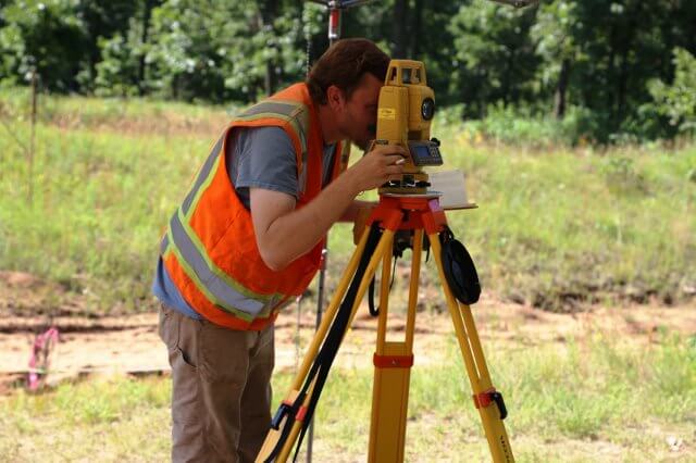
A Total Station is an advanced surveying instrument that combines an electronic theodolite for angle measurement and an electronic distance measuring device (EDM) for distance measurements. This allows surveyors to obtain both angle and distance data in one go, significantly increasing the speed and accuracy of the survey process.
7. Photogrammetry
Photogrammetry is the technique of using photographs, usually taken from drones or aerial platforms, to create maps, 3D models, and measurements of the surveyed area. This method is particularly useful for surveying large or difficult-to-reach areas like mountains, forests, or urban environments.
8. LIDAR Surveying (Light Detection and Ranging)
LIDAR surveying is a remote sensing technique that uses laser pulses to measure distances between the sensor and the target surface. The technology works by emitting laser beams and recording the time it takes for them to return after hitting a surface.
9. Remote Sensing
Remote sensing is the process of collecting data from a distance, typically using satellites or aerial sensors. This method provides a broad overview of the land and is often used for mapping, land use planning, and environmental monitoring.
In Conclusion
Surveying in civil engineering is a crucial component of civil engineering that brings more logic and analytics to science. It helps professionals make informed decisions and be more confident and responsible with their designs. Looking ahead, surveying will be an in-demand skill in top companies to create more efficient projects in a smaller timeline.
If you are interested in learning what is surveying in civil engineering, we suggest you explore the BIM Professional Course for Civil Engineers by Novatr. It is a unique program that offers insights into the concepts of civil engineering, including surveying. The course shares knowledge about BIM tools, software, and processes; while being delivered by industry experts. Throughout the course, people learn how to apply their learnings to real-life design challenges in the form of capstone projects. Additionally, Novatr provides portfolio creation and placement assistance to help learners secure jobs in their desired companies.
Explore the course today!
Visit our Resources Page to learn about the latest built environment developments.
Was this content helpful to you


