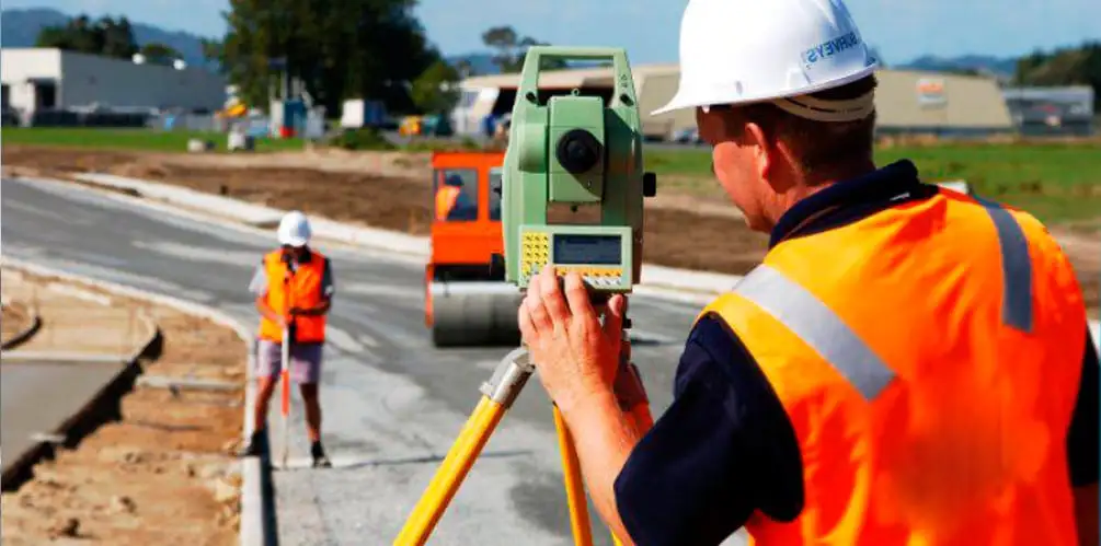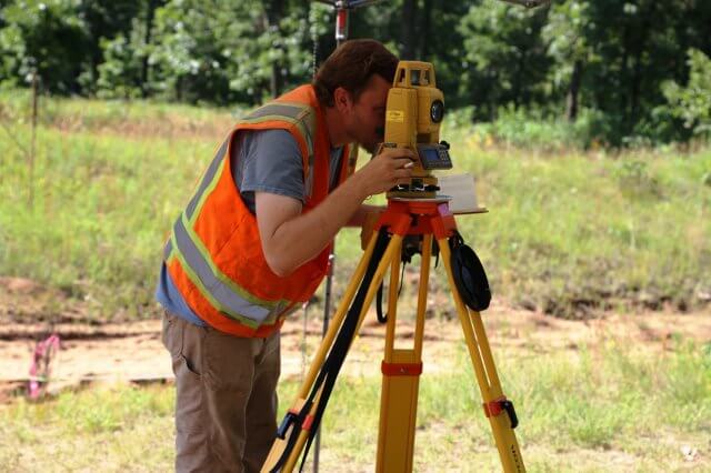
Surveying is the science of measuring and mapping out land area. It involves taking accurate dimensions to determine distances, angles, contours, and elevations between multiple points on the Earth’s surface. It serves a vital role in the built environment, particularly benefitting people in the niche of civil engineering, construction, urban design, landscape design, and conservation architecture.
Typically, this activity is conducted by surveyors with a sound knowledge of civil engineering, alongside excellent observation and analytical skills. They assess terrain conditions, existing structures, and underground utilities; ensuring seamless data integration. Various instruments and technologies are used to achieve the desired data, based on the type and classification of surveying in civil engineering.
What are the Types of Survey in Civil Engineering?

If you are toying with the question- “how many types of survey in civil engineering”, here’s the answer for you. Surveying can be categorised based on types and classifications; which can be further broken down into sub-parts. So, first let’s understand the two key types of surveying methods in civil engineering.
1. Plane Surveying
Plane surveying considers the Earth’s surface as a flat plane for all measurement purposes. As one of the most conventional types of survey in civil engineering is suitable for smaller areas spanning less than 250 square kilometres because the difference in the Earth’s curvature is negligible in a shorter distance. It is commonly used for construction projects, property surveys, and mapping small urban areas where simple calculations are preferable for ease of workflow efficiency. This is a more cost-effective and relatively straightforward way to survey lands.
|
Advantages |
Disadvantages |
|
It is easier and quicker to perform |
It has limited accuracy for larger areas |
|
It requires simpler, less expensive equipment |
Its equipment may not be suitable for larger terrains. |
|
It is ideal for small, localised projects like defining property boundaries. |
It completely ignores the Earth’s curvature which may lead to a lack of precision. |
Related Read: What is Plane Table Survey: Instruments, Types & Methods Used
2. Geodetic Surveying
Further answering the question- “how many types of survey in civil engineering”, the second type is geodetic surveying. It is the process of documenting large sections of the Earth, taking into account the Earth’s spherical nature. This approach is useful for determining international boundaries, continental mapping, and urban-level infrastructure projects that extend over 250 square kilometres. It requires the use of advanced technologies like satellite positioning systems and Global Positioning System (GPS). It takes into account complex mathematical models, atmospheric refraction, and gravitational variations.
|
Advantages |
Disadvantages |
|
Geodetic survey provides accuracy over longer distances. |
It requires specialised and expensive tools. |
|
It aids the establishment of global coordinate systems. |
Its calculations and adjustments can be time-consuming. |
|
It is suitable for GIS applications. |
It requires professionals to have a higher level of expertise and training. |
Classification of Surveying in Civil Engineering:

Now, that you’ve understood types of surveying methods in civil engineering, let’s indulge in the further bifurcations of surveying activities.
1. Based on Purpose
This is one of the most unique types of survey in civil engineering that is based on its intended purpose to serve specific project goals. It is useful for highly targeted and relevant data that aligns with project needs, improving accuracy and decision-making. However, it’s evaluations are restricted to certain industries and tasks.
-
Archaeological Survey
It is used by conservation architects, historians, and archaeologists to document and analyse heritage sites. It assists in the preservation of artefacts and ancient structures.
-
Geological Survey
Preferred by geologists, this is one of the most niche types of survey in civil engineering that focuses on studying the Earth’s structure, rock formations, and mineral deposits. It is beneficial for infrastructure development and natural resource management.
-
Mine Survey
It is a specialised survey that monitors underground and surface mines, thereby ensuring safety and efficiency in resource extraction.
-
Military Survey
As an extension of national intelligence services, this one is used to create maps for military operations and strategic planning. It incorporates terrain analysis to support defence and tactical missions.
2. Based on the Nature of Surveyed Area
Classification by nature involves taking into account the environmental characteristics of the location being measured. This can range from land to water or even astronomical spaces. It enables surveyors to adapt to specific land conditions whether on the surface or underwater. It is helpful for marine construction and harbour projects. The advantage of this classification is that it allows for more precise and context-sensitive data gathering. The drawback here would be that it may be resource-intensive and time-consuming.
-
Land Survey
It focuses on measuring terrestrial areas to support construction, property development, and landscape planning. This ensures land use efficiency and accurate boundary mapping.
-
Cadastral Survey
It is conducted to determine legal land boundaries, aiding in property ownership records and helping prevent disputes related to property limits.
-
Astronomical Survey
It utilises celestial observations to determine large-scale geographic positions, often used in mapping large areas where terrestrial landmarks are unavailable.
-
Engineering Survey
It provides data for infrastructure design and construction, including roads, bridges, and buildings, ensuring structural stability and proper alignment.
-
Marine Survey
It involves surveying coastal areas and seabeds, often supporting port development, offshore construction, and environmental monitoring.
-
Hydrographic Survey
It is used to conduct to measure depths, tides, and underwater features, essential for navigation safety, harbor maintenance, and underwater engineering projects.

3. Based on Instruments
As one of the most technical types of survey in civil engineering, this category is distinguished on the basis of equipment. The instruments can range from basic tapes and chains to complex Electronic Distance Measurement (EDM) tools. This classification is especially useful for projects that require specific levels of accuracy and speed. The demerits of this surveying category include high costs associated with acquiring and maintaining sophisticated equipment as well as skilled labour.
-
Optical Survey
It uses optical instruments like levels and transit to measure elevations and angles, commonly applied in land surveying for road and building construction.
-
Remote Sensing
It involves capturing data from satellites or drones, allowing for large-scale mapping and monitoring with minimal ground presence, ideal for environmental studies and urban planning.
-
Compass Survey
It employs a magnetic compass to measure directions, often used for rough surveys in dense areas or where precision is less critical. However, there are two types of compass in surveying, prismatic compass and survey compass.
It utilises a theodolite to measure horizontal and vertical angles with high accuracy, ideal for precise measurements in construction and infrastructure projects.
The chain surveying in civil engineering uses chains or tapes for linear measurements, suitable for small, flat areas with simple layouts, often used in land boundaries.
A specialized technique within plane surveying that involves using a drawing board (plane table) directly on-site to draft maps or plots in real-time.
-
GPS Survey
It uses Global Positioning System (GPS) technology to obtain precise location data over large areas, facilitating modern mapping, urban planning, and construction projects.
4. Based on Methodology
Considered as the most unique types of survey in civil engineering, this classification is determined by the approach used for collecting and analysing data. Each methodology has peculiar procedures and is selected based on project-specific data requirements. The advantages of this classification include flexibility and precision. Its disadvantages include the complexity of certain methods that may demand more investment of time, skills, and other resources.
-
Triangulation Survey
It utilises a network of triangles to determine distances and angles across large areas, providing high accuracy for large-scale mapping and topographical studies.
-
Traverse Survey
It involves measuring distances and angles along a series of connected lines, ideal for linear projects like roads and railways, where continuous mapping is necessary.
In Conclusion
Learning the various types of survey in civil engineering is one of the most essential skills you must develop as a civil engineer. It helps you develop an innate understanding of land contours, topographies, and behaviour through your practical experiences. For this purpose, you must invest in upskilling yourself through relevant courses.
If you want to upskill as an civil engineer with a tech-first approach, we recommend you enrol in the BIM Professional Course for Civil Engineers by Novatr. It is a unique program that offers knowledge about new-age tools, software, and technologies that help civil engineers excel at work. This course is led by practising professionals working in top construction firms across the globe who share their learnings through live examples. Further, the students work on capstone projects to apply their skills to real-time civil engineering challenges. Additionally, Novatr provides portfolio creation and placement assistance to help students secure jobs in the best civil engineering companies around the world.
Explore the course today!
Visit our Resources Page for the latest developments in the built environment.
Was this content helpful to you


